Remove GPS Location from a Photo Before Sharing
Inspect photo location fields, choose GPS or selected-category removal, and check the downloaded copy before sharing it.

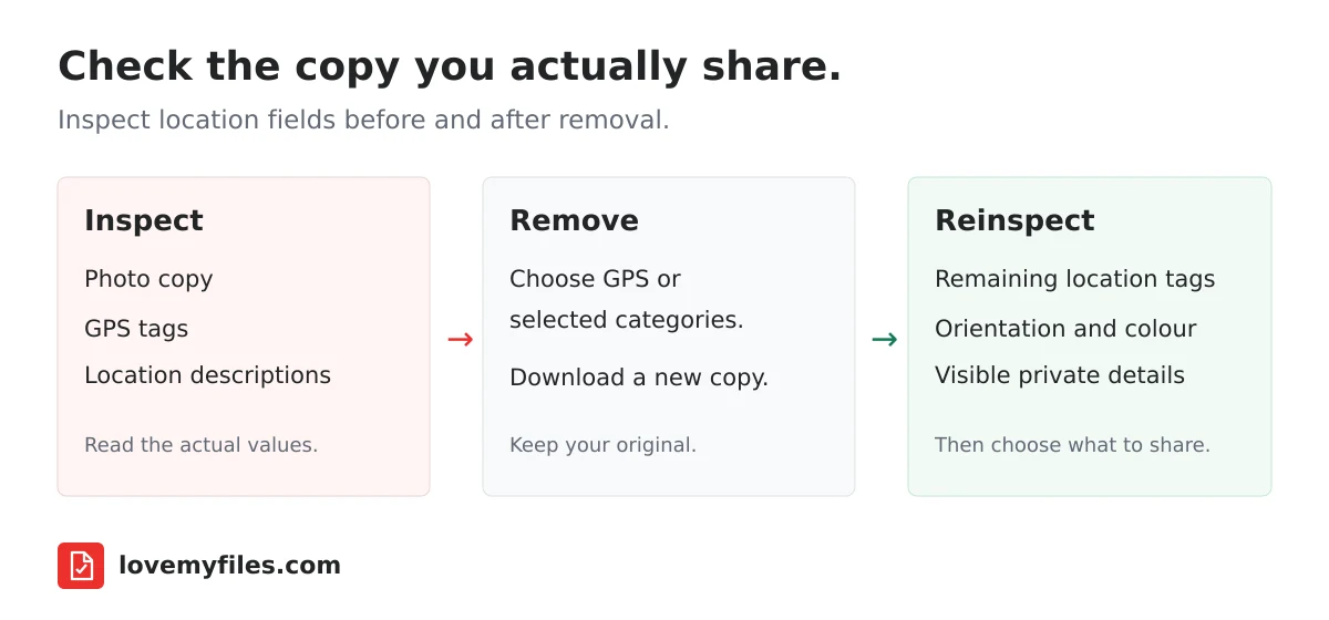
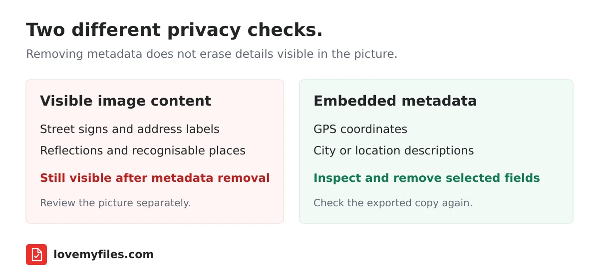
Remove location information from a copy of the photo, download that copy, and inspect it again before sending it. Do not assume that cropping, changing the filename or uploading to a messaging app removes every location field. Also check the picture itself: a street sign, address label or recognisable building can reveal a place even when the file contains no GPS coordinates.
The Image Metadata Viewer & Remover lets you inspect supported JPG, PNG and WebP files and choose which metadata to remove. For a privacy-focused workflow, start with inspection rather than immediately deleting everything. That gives you a clearer idea of what was present and what remains in the downloaded copy.
What location metadata actually tells someone
A photo has visible image content and may also contain descriptive fields. Those fields can include capture time, camera details, copyright information and location coordinates. They are not the same as text drawn on the picture. Removing them does not erase an address photographed on an envelope or a location printed in a caption.
GPS latitude and longitude are the most obvious location fields, but they are not the only ones worth checking. Location names can also appear in descriptive metadata, such as a city, country or sublocation. The LoveMyFiles report groups recognised fields into categories, including Location, Device, Time, Ownership, Preview and Color. Inspect the individual values, not just the number of fields.
A blank location category does not establish that the picture is anonymous. The report concerns embedded fields recognised by the inspection engine. It does not analyse buildings, reflections, faces, licence plates or clues in the filename. Treat it as one part of preparing a photo for sharing, not a guarantee that nobody can identify where it was taken.
Choose the smallest change that solves your problem
GPS removal
Use GPS removal when you specifically want to remove recognised GPS-related tags while leaving unrelated metadata alone. This is a narrower operation than removing every descriptive field. Check the exported copy for remaining city names, captions or other location descriptions if those are sensitive too.
Selected-category removal
If both coordinates and written location descriptions matter, inspect the Location category and use selected-category removal where appropriate. The implementation attempts to delete recognised writable fields in the selected categories. Some fields may be read-only or unsupported for removal; the after-processing report matters more than an assumption that choosing a category guarantees an empty file.
All-metadata removal
Choose all-metadata removal only when you understand the trade-offs. Orientation information can affect how a viewer displays a phone photo. Colour profiles can affect appearance. Copyright and attribution fields may be useful or required in your workflow. Keep your original and compare the exported copy before distributing it.
ExifTool's own documentation notes that complete metadata removal is format-dependent. Do not treat an all-metadata option as a promise that every possible field in every supported container will disappear. Inspect the actual output and use a narrower operation when you need to retain colour or ownership information.
How to prepare a copy with LoveMyFiles
- Keep the original in a separate folder. Give the sharing copy a name that does not reveal a private address or customer name.
- Open the image metadata tool and select a supported image. This utility accepts JPG, PNG and WebP, with a 30 MB file limit and a 50-megapixel image limit.
- Inspect the report. Read the Location entries and any captions or ownership fields that might expose information you do not intend to share.
- Choose GPS, selected categories or all metadata according to the information you want removed. Avoid deleting useful colour and attribution fields without a reason.
- Download the processed copy. Confirm that you are opening the downloaded file, not the original or a cached thumbnail.
- Inspect the downloaded copy again. Check location values, remaining categories, orientation and colour. Finally, inspect the visible picture and its filename.
This metadata utility processes files on the LoveMyFiles server using local open-source tooling. It is not a browser-only operation. Its temporary processing directory is removed when the request finishes, including the error path. That implementation detail should not be confused with the separate retention rules of other tools, or with a claim about every copy in network infrastructure or backups.
Removing location from an iPhone photo
Apple provides controls for managing location metadata and sharing a photo without its location. Its location-metadata guide describes the relevant Photos controls. Follow the instructions for your device and software version rather than assuming every sharing screen is identical.
The important practical distinction is between changing information attached to a photo and controlling information sent in a particular share. Before sending an important image, inspect the exported attachment when possible. A setting used for one share should not be treated as proof that every previous or future copy has changed.
If your source is HEIC and you need the LoveMyFiles metadata utility, create a compatible copy with HEIC to JPG. Conversion is not, by itself, a privacy verification step. Inspect the converted file before sharing it. The existing iPhone photo upload guide explains format and upload-size problems separately.
What to check on Android and desktop
Photo apps and file managers differ in the information they show. An app may display a map, a location name or no location at all. Do not interpret an interface that hides details as evidence that the underlying file contains none. Use the downloaded copy's metadata report when you need to check embedded fields.
On desktop, keep the original and cleaned copy visibly separate. Similar filenames make it easy to attach the wrong one. Open the exported image in a normal viewer, confirm that it displays correctly, and then inspect that exact file. If you organise images in a cloud library, remember that information stored by the library is a different subject from metadata embedded in a downloaded image.
Removing embedded GPS data does not remove account history, cloud-library records or earlier attachments that have already been sent. This workflow prepares the file you are about to distribute; it is not a way to recall previous copies.
Why cropping and compression are not enough
Cropping changes visible content. Metadata removal changes descriptive fields. Sometimes you need both: crop a delivery label out of the picture and remove embedded coordinates from the exported copy. After cropping an image, inspect the final output instead of assuming the crop operation guarantees privacy.
Compression is a different task again. It may re-encode an image, change its format or keep the original if encoding would make it larger. In the original-kept case, embedded metadata can remain exactly as it was. Use image compression for upload size, not as a substitute for metadata inspection.
If you need several changes, finish the editing and format-conversion steps first, then inspect the file you actually intend to send. This avoids checking one copy and later sharing another export. The image-format guide can help when compatibility or transparency affects the format you choose.
Troubleshooting the downloaded result
No GPS fields were found
The photo may never have contained coordinates, or a previous export may have removed them. Check for written location descriptions and visible clues. Do not repeatedly process the same file merely to make its field count smaller; first decide whether the remaining fields matter to your sharing task.
A field remains after removal
Read its name and value. Some report entries describe the file's structure, while others may be non-writable or outside the selected removal scope. If a location description remains after GPS-only removal, review selected Location removal. If you cannot establish what remains, do not share a sensitive file on the strength of a success message alone.
The image is sideways or looks different
Compare it with the original in the same viewer. Broad metadata removal can remove orientation or colour information. Return to your original and try narrower location removal instead of repeatedly editing the altered copy. Preserve the original for print, archive or attribution-sensitive work.
The file is rejected
Check the format, bytes and dimensions. A small JPEG can still exceed the pixel limit, and renaming an unsupported file to .jpg does not convert it. Use the appropriate converter for a compatible copy, then reopen it. The larger-JPEG allowance in English image compression does not increase this metadata utility's 50-megapixel limit.
Questions before you share
Does removing GPS hide my home address?
It removes recognised embedded GPS tags in the processed copy, not everything that could identify your home. An address in the picture, a recognisable view, a filename or accompanying message can still reveal it. Inspect those separately.
Does this change the original on my computer?
The tool returns a processed download. Keep the original and choose the downloaded copy for sharing. Do not overwrite your only original unless you have independently verified and backed up what you need.
Can I inspect HEIC directly in this metadata tool?
This utility's supported image inputs are JPG, PNG and WebP. Convert HEIC to a compatible copy first, then inspect that copy. Do not infer support from the broader format list in the separate Image Converter.
Is a screenshot guaranteed to contain no private information?
No. A screenshot can show an address, account name, map or notification even without capture-location metadata. It also needs its own file inspection. Review visible content and embedded fields rather than relying on the way the image was created.
Final sharing checklist
Use the final downloaded copy. Reinspect its location fields. Confirm orientation and colour. Check the picture for visible identifiers. Rename it if the filename is sensitive. Attach that copy, not the original. These checks are more useful than assuming one operation makes every photo safe for every audience.
Sources
Try a related tool
Inspect embedded metadata in JPG, PNG and WebP photos. Remove GPS tags, choose sensitive metadata categories, or clear embedded metadata before downloading a separate copy.
Image Metadata Viewer & RemoverRelated Guides
Organise Scanned Receipts and Documents into a Usable Sharing Copy
Prepare clear document images, group related PDFs, extract text when appropriate and check privacy without treating OCR output as verified financial data.

Compress a Large Print JPEG for Sharing: Pixels, Size and Colour
Prepare a lighter sharing copy of large JPEG artwork. Understand pixel limits, colour conversion, target size and why you should keep the print master.

Build an Event Sharing Kit with PDFs, Images, Short Links and QR
Prepare an event PDF, screen images, a managed link and a printable QR. Check privacy, file quality and the complete visitor journey before sharing.
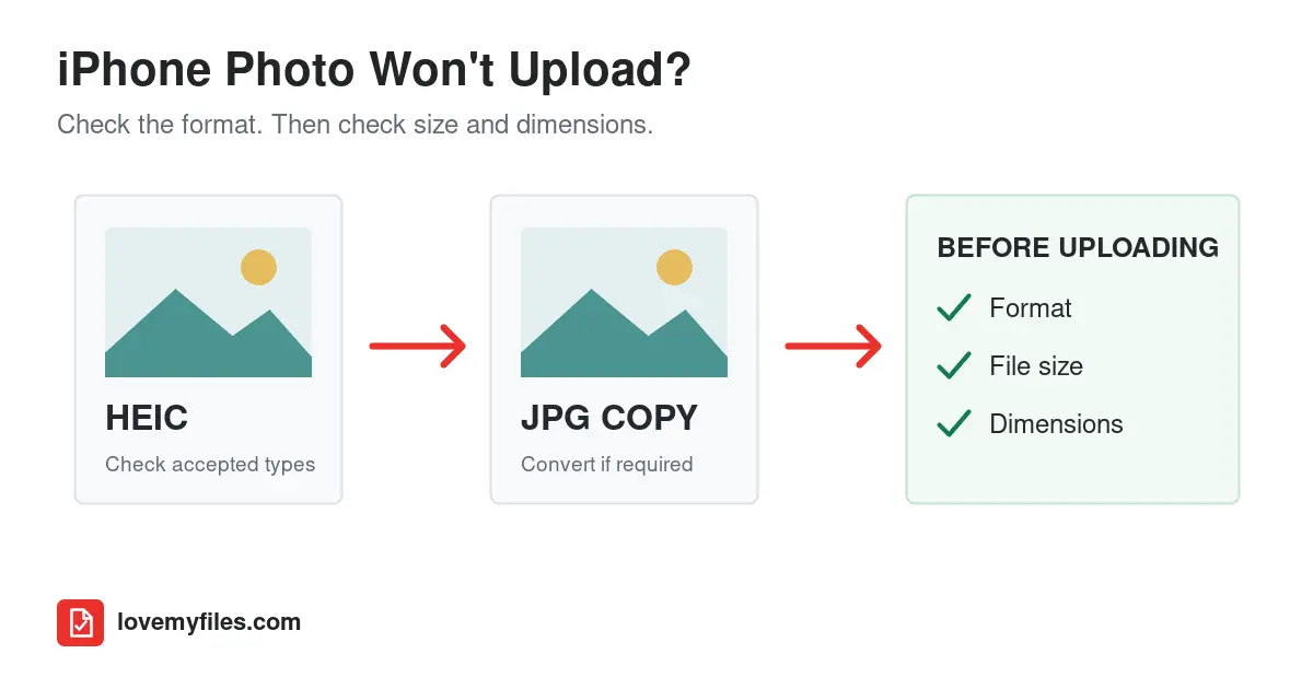
Why Won't My iPhone Photo Upload? Fix HEIC, JPG & File-Size Errors
If a form rejects your iPhone photo, check its accepted formats, file size and pixel dimensions. Convert HEIC only when needed, then compress or resize the compatible copy and reopen it before uploading.